In the survey of 1862 the castle is there but the gate lodges are not. This is the first evidence I have had of the gate lodges being later than the official completion date (1860) of the castle. In the survey of 1900 the gate lodges, as expected, are present.
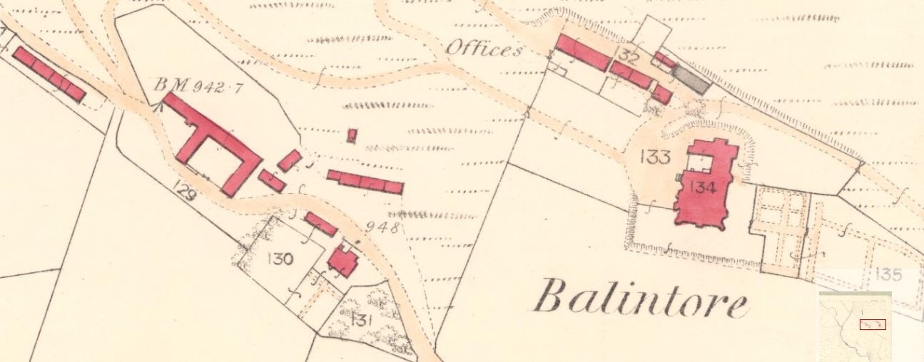
The most interesting revelation concerns the triangular kitchen structure attached to the side of the eastern gate house, clearly seen in the 1900 map. In the 1862 map there is a pre-existing building in this location. From the angles involved, there seems to be a strong possibility that the gate lodge kitchen is part of the old structure, whereas I had always assumed it was contemporaneous with the gate lodge itself.
 |
| 1862 - no gate lodges but note pre-existing building on site of east lodge |
 |
| 1900 - gate lodges present with triangular structure attached to east lodge |
Between 1862 and 1900 there are also considerable changes in the area of the castle. Most noteworthy is the doubling in width of what are now the castle's stables. And indeed, an inspection of this building several years ago revealed some internal windows that had clearly once been external. The structure was labelled "Offices" in the 1862 map and may well have been the site offices for the construction of the castle. The maps below corroborate this change.
 |
| 1862 - castle |
 |
| 1900 - castle, note stables have doubled in width |
It's amazing how much I have learned about the history of the site in simply trying to draw a plan. :-)
Fewer things are more enjoyable than old maps!
ReplyDelete